View Photo
| Photo Albums > IRL Station Photos > Soldiers's Point |  |
 |
 |
 |
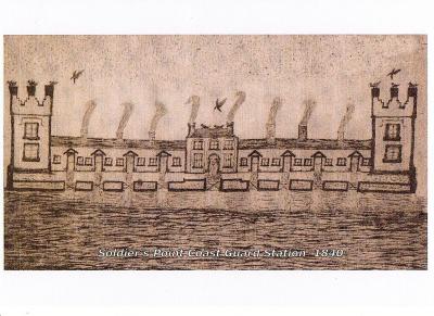
A section of a hand drawn map showing proposed new course for the river and harbour of Dundalk in 1840. Showing the buildings as originally built with castellated towers at each end and single story thatched houses either side of the Inspecting Commanrer's two storey slated house. the single story boulder built houses were raised with and the end towers incorporated under slate roofs at a later unknown stage. The seashore also came up to the road in front a that time.
Date: 27/03/2009
Added by: POYNT
Dimensions: 1024 x 746 pixels
Filesize: 303.73kB
Comments: 0
Number of views: 4379
Date: 27/03/2009
Added by: POYNT
Dimensions: 1024 x 746 pixels
Filesize: 303.73kB
Comments: 0
Number of views: 4379
Comments
No Comments have been Posted.
Post Comment
Please Login to Post a Comment.


